Evan Brashier: An Interview with the author of the ‘El Camino de Costa Rica Hiking Guide’
Words Conchita Espino, Executive Director of Asociación Mar a Mar
Evan, I understand you are the author of a new hiking guide book for El Camino de Costa Rica. Can you share with us what makes this trail unique and special for you?
How many hiking trails let you cross a continent in two weeks? El Camino de Costa Rica provides that opportunity, with plenty of surprises and challenges along the way.
Before I attempted the trail, my experience was mainly on routes in unpopulated areas: deserts, forests, and mountains. These are environments people often seek in order to escape from crowds, and to be in nature. And that is what I expected from a trail across Costa Rica: very little civilization. But I found the opposite, and that is what makes it different and appealing.
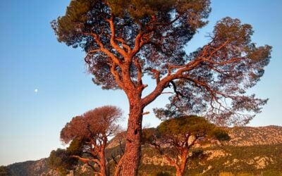
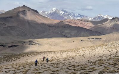
The coast-to-coast trail exposes hikers to many sizes and types of communities in Costa Rica. There are coastal fishing villages, scattered farms and ranches in the hills, cities conveniently located for buying supplies, and tiny mountain communities that depend on coffee production. There is also a section through indigenous territory where Spanish is not the primary language, and the culture is agrarian. The recommended lodging option is to stay in homes along the trail, with families that offer meals and either rent rooms or permit campers on their property. This provides the most immersive experience.Of course, there are also stretches of wilderness, with wide rivers to cross and slopes to ascend. There are three National Parks adjacent to the trail, and panoramic views of volcanoes, mountain ranges, and the Pacific. There are long sections on the sides of shaded river valleys, and passage through two nature preserves. But most of the trail goes through or near rural areas, or traces the border of pastures and farms. So, if a hiker wants full-spectrum exposure to Costa Rica, this trail is the way to get it.

Tell us a bit about yourself and how you became involved with writing a guide for hikers on El Camino de Costa Rica. What about the trail caught your attention? What were you doing when the project started that made this possible for you?
When I was preparing to transition out of the United States Marine Corps after more than a decade of service, I wanted a career where I could leverage the knowledge and experience I had acquired as an infantry officer, and before that as a volunteer in the Peace Corps. My background included training in land navigation, first aid, cross-cultural communication, and survival in different environments. I also wanted to enjoy the freedom to travel without the regulations imposed by the military. Hoping to combine those objectives, but definitely prioritizing travel first, I bought a backpack and explored trails that fit into my work schedule. In the fall of 2018, the right combination of words in a search engine led me to El Camino de Costa Rica. It was relatively close, and could be completed in two weeks with time to spare.
There were few resources for someone who wanted to hike the trail without using a tour service, so I contacted Asociación Mar a Mar, the organization that had shepherded the trail into existence, and explained my intent. The staff was skeptical at first: even the website discouraged people from hiking without a guide. El Camino de Costa Rica also passes through indigenous territory, where a local guide is required. But the combination of my resume and persistence convinced Conchita, the Executive Director, to provide me with contact information so I could find an indigenous guide and arrange my lodging. I think she understood that I was going to attempt the trail regardless, and decided it would be better if I did not get hopelessly lost in the jungle.
In return, I offered to provide a summary of my experience on the trail. This grew into a 50-page report that included my preparatory training, itinerary, costs, and gear. I also compared the route I had followed, based on the maps I had generated in PowerPoint from website screenshots, to the actual route. This illustrated where I had deviated from the trail, and why. The inclination to write a guide book developed out of this project.

On your first hike what were the most unexpected sections, or the most challenging aspects of that journey?
On that first hike, many gaps in my preparation exposed themselves. Without an internet connection or mobile signal while hiking, there was no way to check which direction to turn if signs were missing or unclear. Whenever I realized I had strayed from the trail, I either had to backtrack, or orient my homemade map to the terrain and navigate to an identifiable feature, like a road that intersected with the route. Sometimes, the distance between signs was so great, I turned back just to confirm my sanity only to cover the same section again.
Fortunately, my military experience had provided me with the technical skills to resolve such navigational issues. I also had completed other hikes of a similar distance, like the route that circles the Spanish Sierra Nevada, or the route that crosses the Mojave Desert in California. And I was familiar with my equipment and the limits of my body, in terms of nutritional requirements and physical capabilities. All of this gave me the confidence to accept the challenges encountered while making my way through an unfamiliar country where I did not speak the language.
I should mention that one aspect of my first crossing which did not pose a problem was lodging. Using the information provided by Asociación Mar a Mar, which is amplified in the guide book, I had coordinated almost every stop before I left the United States. I remained on schedule, and spent many nights in rooms rented in family homes. This is part of the immersive experience offered by El Camino de Costa Rica that makes it special, and something I would recommend to other hikers when they make plans: arrange homestays in advance and enjoy the exposure to the culture of Costa Rica.
I understand you returned several times to Costa Rica, including in the midst of the pandemic in 2020, when you stayed for over a month to gather data for the book. Did you face some challenging moments?
What was the biggest challenge of traveling in Costa Rica in 2020, aside from convincing the immigration officer to let me enter the country? Time. Even one month felt too short, because I had expected to stay until the book was finished. Instead, because of the tight restrictions, I dashed from place to place in a rented car to capture the details of every turn. In some areas, that meant parking and hiking a section in both directions: out to measure the trail, and back to return to the car. And I learned a valuable lesson about driving on unlit, unfamiliar dirt roads in the mountains at night: don’t. The car did not slide into the pit, but I slept there until morning, when a recovery crew arrived to lower the vehicle down the slope using winches and chains. With more time, I might not have taken such dangerous shortcuts.
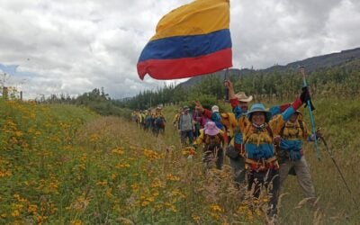
Opportunities also arose during that trip. I was able to logistically support two long-distance athletes, Sandra Mejía Céspedes and Jose Pablo Cob Barboza, as they ran the trail to raise funds for families affected by the pandemic. Stores were losing customers, markets were closing, and small businesses that relied on tourists were struggling. The runners covered the trail in just under three days, and provided aid to several communities along the way. It showed me how much the people of the villages support each other, and how much tourism can help rural economies.

How did you research the niche of the book market related to hiking guides in order to define the structure of your book? What were the most important objectives for you in producing it?
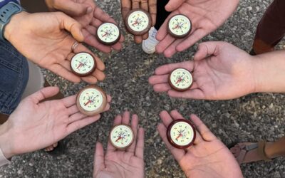
The guide book needed to enable a person to access the trail and complete it using only the information in the book. To develop content that met this requirement, I referred to hiking and travel publications to see what information was included and how it was presented. That is how I found a method of rating section difficulty in the Gran Recorrido 240 Sendero Sulayr guide, published by Penibética. None of the grading scales used in mountain climbing were applicable, but the Método de Información de Excursiones (MIDE) approach to rating trails used by the Spanish Federation of Mountain Sports and Climbing (FEDME) provided the granularity I wanted, and that book included it.
I also knew that maps were critical, but without access to current maps based on a grid system, I decided to create my own. I found guide books with hand-drawn or stylized maps, and combined elements of what worked to generate the maps for El Camino de Costa Rica. The maps by Marsha Mello in the two volumes of Hiking the California Coastal Trail, by Bob Lorentzen and Richard Nichols, were particularly helpful.
The pictures in the book were chosen for function first, and aesthetics second. On my initial hike, I only carried a mobile phone for photos. Some pictures of landmarks were taken on that phone’s weak camera in poor conditions. On subsequent visits I returned to several sites to collect better images, but it was difficult to predict exactly which church, restaurant, or water tower would get a mention in the book and need a corresponding photo. I’m sure it looked odd to other hikers and local residents. “Why is that tourist taking a picture of the gas station?” But now, with the guide book, there are many places along the trail where a hiker can read about the location, see it both on the page and in real life, confirm it on the map, and be confident to continue.
How did this experience affect your personal life? Are you glad to have taken on this big challenge?
I never anticipated the length of time required to finish the guide book, but it provided a sense of purpose that eased my transition out of the military. If not for the pandemic, I would have spent the summer of 2020 completing it. Instead, my final visit to collect data was over the month of September that year. And during that time, I met Isamar, who is now my fiancé. Her field is natural resource management: she understood the value of a book to help tourists explore the wilderness and rural communities of Costa Rica, and was supportive and patient while I developed it for another nine months. Now she and I discuss starting a project together that will also take nine months to finish.

In looking towards perhaps a second edition what would you want to add or change?
Before releasing a second edition, I want to revisit the trail and confirm the directions, distances, and descriptions. I would also validate and add to the information provided about the families that offer lodging and other businesses along the way. Currently the guide book can help a person conduct the necessary coordination and hike the trail independently: the challenge is lodging. Camping in random places along El Camino de Costa Rica is not recommended, and would usually require trespassing on private land. But the more hikers visit the trail, the more local people will open their homes and rent sleeping space. I would like to see the growth of these rural economies, but the two components must develop together: more hikers will encourage entrepreneurs, and more local businesses will enable hikers.
Even when those conditions are met, I would encourage hikers to make reservations in advance. It boosts confidence to have a confirmed place to stop for the night, and respects the schedules of the families generous enough to let strangers sleep in a spare room or pitch a tent in the yard. That is a point I would emphasize in later editions: plan ahead, and expect to experience different lifestyles in Costa Rica. The trail can be completed in three days: I have seen it done. But it could also be enjoyed for three weeks, with homestays and farm tours, tastings of coffee and chocolate, side trips to nearby National Parks, and a multitude of other adventures easily accessible from El Camino de Costa Rica.
NOTE: ‘El Camino de Costa Rica Hiking Guide’ is a 160-page book will all information you need to hike El Camino de Costa Rica. It is available on Amazon.