Walking and Wayfinding in the Westfjords of Iceland
Words by Henry Fletcher – Trail Advocate & Author
Trail advocates and authors Henry Fletcher and Jay Simpson adopt a unique approach to reawakening trails in a remote corner of Iceland.
Very seldom does one find a publication such as this: at once totally practical, beautifully done, with a touch of whimsy and thoroughly wild and well-written. The subject is important for both people and wild nature…and it’s an enjoyable read. Congratulations, Henry and Jay!“
Vance G. Martin, WILD Foundation | Wilderness Specialist Group (IUCN)

Having graduated, I spent time working as a nature guide in the UK, Sweden and South Africa. It was on an emergent trails project in South Africa, called Rim of Africa, that I met Jay Simpson, a wilderness guide, multimedia storyteller and anthropologist. He had been awarded a National Geographic Young Explorers Grant to identify a path ahead and on behalf of the group I was guiding and running logistics for.
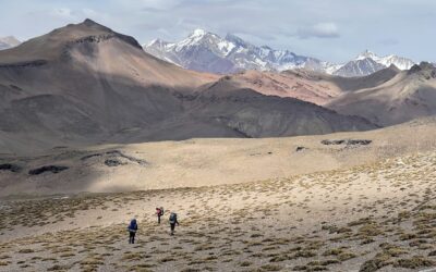
Walking the Rim of Africa trail, seeing its unique combination of conservation and adventure, inspired me to return to the Westfjords a couple of years later. I aimed to identify a long-distance, ecologically-themed trail between the region’s capital, Ísafjörður, and the puffin-inhabited cliffs at Látrabjarg. To do this required that I link together historic herding and walking routes that were in use before the development of roads, as well as to find a way to cross the numerous stretches of wild water that characterise this fjordian land/seascape.
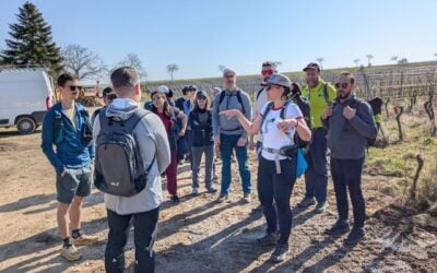
To test the viability of this concept, we were joined by a couple of courageous client groups who we pushed to the max – traipsing huge, mountain snow fields then paddling, chased across windswept fjords by a herd of “white horses”. Often, the land and seascape resisted our attempts at linearity. We instead found routes connecting just one valley to another, or one fjord to another—it’s a place of detours and dead ends, for walking and staying, and not so easily thru-hiked (though we did manage some of this, too!).

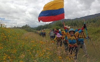
These early discoveries informed our work going forward. We subsequently acquired a conservation grant from the European Outdoor Conservation Association to restore some of the old routes’ original waymakers—cairns, also to plant native birch and rowan trees. We carried out this work with international volunteers who we guided using a range of practices designed to help deepen their relationship to ecology and place.
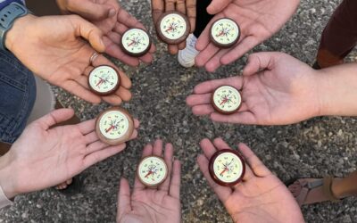
These practices we came to call ‘wayfinding practices’ and they include: wild-walking and camping, swimming hot & cold, foraging, storytelling, ceremony, creative response and the simple practice of slowing down to listen. In leading walking artist residencies, volunteer workcamps and client hiking trips, we were able to identify some of the hi(stories) that these old trails carry.

A guidebook project seemed a beautiful way to bring together this knowledge in a way that met Jay and I’s creative longings. I like to write and manage projects while Jay likes to take photos, document and bring things together digitally; as with our respective approaches to guiding, we compliment each other creatively; our three books and map are evidence of that!
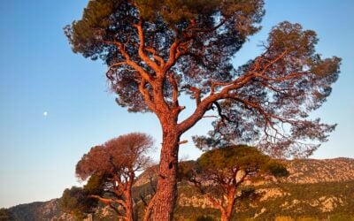
We are positioning our main book, Wayfinding in the Westfjords, as a poetic celebration of place, combining rich visual imagery with reflective storytelling. We hope it will speak to both an international and Icelandic audience (we have Icelandic translation for all our materials). The two smaller books Notes on Ecology and Notes on Walking, as well as the Westfjords Trails Map are designed to be carried and are more practical, with extensive coverage of hiking opportunities, and descriptions for over 80 species, written from a cultural-ecology angle. The trails map features all routes described in Notes on Walking, plus those used for mountain and road biking, running and even historically resonant sea-trails.

The Westfjords are changing. The region has recently begun positioning itself as Iceland’s second ring-road destination to attract more car journey tourists. A new modern tunnel and increasingly paved roads are facilitating this narrative. Our trails-focused work and guidebooks offer an alternative and complementary vision for tourism in the Westfjords. It’s a song waiting to be sung: a modern fleet of electric vehicles facilitating the dispersal of visitors within a curated network of trails connecting place-specific history, culture and ecology.