The Sultans Trail – A cultural adventure
Words Max Smits, Coordinator of the Sultans Trail
The Sultans Trail covers a part of Europe that had to deal with the Ottoman rule for several centuries. It runs from Vienna, which was under Ottoman attack twice, to Istanbul, the heart of the Empire. During Ottoman times, some areas were more affected than others. Some regions suffered severe war consequences, massive devastation and depopulation. Others had a profound Ottoman influence on their development which made a serious imprint on local culture. In any case, Ottoman history – to some people – is still hard to acknowledge and deal with. The trail introduces the traveler to this legacy, but also the beautiful countryside and local contemporary culture.
The prologue of the trail starts at Kahlenberg, one of the hills in the ‘Wiener Wald’, the woods north of Vienna, from which the famous Polish King John III Sobieski, charged down on the besieging Ottoman encampment and broke the siege of the city in 1683. This was the second time the Ottomans failed to conquer the capital of their rival, the Hapsburg monarchy. An earlier attempt, some 100 years earlier (1532), did not succeed either. This second one would prove to be the last.

The trail itself leaves from ‘Stephansdom’ [St. Stephen’s Cathedral], with its beautiful tiled roof, in the historic centre of the ancient city, which in its entirety is a UNESCO World Heritage site. Once out of the city the trail follows the lovely Leitha river for a while, which runs parallel to the Danube and for a long time constituted the border with Hungary, until it comes to the former Roman settlement of Carnuntum, which in Roman time was more prominent than Vindobona (Vienna). The Roman remains are omnipresent and spread throughout the fields. On the way to Bratislava, the trail crosses many picturesque medieval villages, some still intact, while the shining white castle of Bratislava grows bigger with every step.

Danube, the dominant element in the landscape
South of the baroque town of Bratislava, where many Hungarian kings were crowned, the Danube enters the marshy flatland of the Pannonian plane, which used to be flooded periodically, causing destruction and mischief to the population. Nowadays the flow is regulated, but some of the old wetlands have been preserved in a nature reserve, which the trail passes through. Unfortunately, all ship mills that floated on the Danube have been abandoned and replaced by alternative power sources.

Halfway between Bratislava and Esztergom lies Komárom, which once controlled the entire plane around it from its mighty castle, safeguarding its hinterland against invasions of nomadic tribes such as the Tatars. It is here that European diplomatic embassies en-route to Istanbul used to change envoys. Being under dual Ottoman and Hapsburg control, Ottoman guards were taking over the escort here. Esztergom was considered the first Ottoman town that the traveler would see on his journey to ‘Top Kapi’ [the Sultan’s Palace in Istanbul], full of minarets, none of which remain.
Esztergom, high on a hill in the Danube bent, was once one of the major cities of the Hungarian Empire, and is still the seat of the Archbishop. Its impressive basilica, on top of the castle hill, dominates the area. Between Esztergom and Budapest, the trail passes through the Pilis mountains, the hunting domain of the Hungarian Kings.

The rich history of Budapest is revealed at the entry of the city by the remains of the enormous Roman settlement of Aquincum. The city itself, inhabited by the Hungarian people since the 10th century, was held under Ottoman reign for some 150 years. At the start of that period the royal castle was destroyed and replaced by a new palace, which again was destroyed when the Ottoman were expelled. It still holds the northern holy shrine for religious Turkish people, who often come to visit it: the Tomb of Gül Baba. And as the Turks enriched Vienna’s culture with coffee, so did they spice up Hungarian cuisine with paprika.
From Budapest, the trail sets out south, along the Danube following the Limes, the Roman border road, through the arable lands of Transdanubia, with its huge fields and an agricultural system inherited from Communist times. Wild puzstas, hills and streams and friendly, sometimes very extensive villages. With a bit of luck, one can catch a glimpse of the traditional equine culture, taste local wine in one of the wine cellars, or see Slivovitz in the making.
The Danube has littered the landscape with marshy areas and wetlands. One of which is the Gemenc National Forest, the largest continuous floodplain forest in Europe. It takes us two days to pass through. One day further south of this floodplain lies the historic battlefield of Mohács where, in 1687, in a few hours, the Hungarian Kingdom has suffered a devastating blow by the Ottoman forces under the command of Sultan Süleyman the Magnificent himself.

At the border of rivaling Empires
Continuing south along the Danube, the trail enters the Serbian Vojvodina Region with a mixture of Serb, Croat and Hungarian-background villages, passes through the ‘Fruska Gora’ (Frankish woods) which harbors a large number of charming orthodox monasteries. Further on, in the fertile flat land lies the old road to Belgrade, on which a friend once found a coin with the image of Maria Theresa.
Belgrade, the much-contested city on the confluence of the Danube and the Sava rivers was destroyed 38 times in history and rebuilt. It was held by Celts and Avars; it was at the border of Charlemagne’s Holy Roman Empire and the Byzantine Empire for a long time. The Ottoman presence lasted here much longer than in the previous sections of the trail which makes it a cultural pivot point.

From here onwards, Byzantine culture becomes prominent and the Latin script is replaced by the Cyrillic one. These lands were nearly 450 years under Ottoman rule, from the mid-15th century to the dawn of the 20th century. At Smederevo, the course of Limes is left behind and exchanged for the Via Militaris, another Roman communication artery. The trail turns south through the Morava valley towards Sofia, passing through old settlements, like Çuprija and Niš, and fortified medieval monasteries like Manasija, as well as the mountains of the Suva Planina. In all, an area which was known to the Byzantines as the Bulgarian forest, vast and impregnable, which, in medieval times, took 8 days to pass.
Bulgaria’s richness
Over the watershed, that separates the Danube basin from the Mediterranean, the plane of Sofia appears with a unique Nature Reserve of karst marshland. The atmosphere has turned “Bulgarian” with distinctive features that are hard to describe. Sofia is a fascinating kaleidoscopic amalgam of historic periods. On top of the remains of Roman Serdica, which are still being excavated, we not only find the exquisite Byzantine Rotunda church of St.George, and the Ottoman Banya Bashi Masjid Mosque, but also the megalith communist structure of the first Bulgarian shopping mall.

Roman Scerdica in the heart of Sofia. Serdika Center (shopping mall) on top and Banya Bashi Masjid mosque in the background 
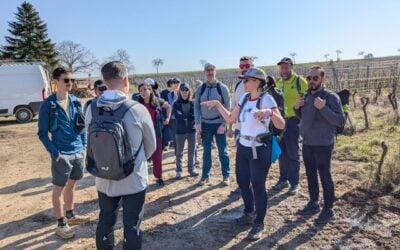
Hiking in northern Bulgaria
Bulgaria carries, with 675km out of a total of 2.200km of trail, most weight. From Sofia, the trail offers two alternative routes. One via Plovdiv and one through the Rila and Rhodope mountains. The former following the old roman itinerary of the Via Militaris; the latter through some of the last remaining wild areas of Europe, land of the Thracian kings, where ancient villages preserve their traditional life.
On the one hand, the Plovdiv Route first climbs out of the Sofia valley, into two mountains ranges separated by wide valleys, to enter then the Thracian valley which stretches all the way to Istanbul. On the last ridge, the Romans built a wall and Trajan’s gate to protect Byzantium and control traffic. The Bulgarians fought fierce battles with the Ottomans here for control over the area. From there, the trail runs gently downhill, along the Maritza river towards Edirne in Turkey. Did the Danube flow to the Black Sea, the Maritza flows towards the sea of Marmara. We are now in the Mediterranean. Along the route we find the town of Pazardzhik, which was created by the Ottomans and populated with migrants from the Crimea. The city of Plovdiv on the other hand traces back to Thracian times. The Dzhumaya mosque in the heart of the city is built on top of walls of the Roman aqueduct, next to the well preserved Roman Stadium (Circus) and the nearby Roman Amphitheatre. In the old town, many Balkan style houses have been preserved. The city, rightly so, was the European Capital of Cultural in 2019.

Dzhumaya mosque in Plovdiv
Balkan style houses on the walls of Plovdiv
From Plovdiv, the trail meanders through the countryside, between the Maritza river and the Rhodope mountains, crossing many rivers, some by Ottoman bridges, until it reaches the famous, multi-arched Ottoman Mustafa Pasha Bridge across the Maritza at Svilengrad. The next station is Edirne, the splendid former capital of the Ottoman Empire until they moved it to captured Constantinople in 1453.
On the other hand, the Rhodope branch first climbs Vitosha mountain (2290m), adjacent Sofia, and a winter ski resort. Next are the Rila mountains, where the trail meets its highest point (2536m) at the flanks of Mechit Peak. On the way down, the traveler is rewarded with a visit to the Byzantine Rila Monastery, a Unesco heritage site and the spiritual centre of Bulgaria. Once the Rila mountains are passed, the lower Rhodope ranges appear, covered in dense wood. In the valleys of the Rhodope, time has lost its meaning and traditional life persists. Tucked away are a few remaining villages of converted Bulgarian Muslim (Pomak), and colourful towns like Smolyan, Kardzhali and Batak. The Arda river leads the way out of the Rhodope, winding its way between the hills, through narrow gorges, wide in places where the water is collected in reservoirs.

The trail leaves the Rhodope and Bulgaria at the town of Ivaylovgrad and has to cover 50kmof Greek soil, before it meets the Turkish border, beyond which we find Edirne. In its heydays, when Edirne was the capital of the Ottoman Empire, the town was elaborated with high-quality cultural monuments and many magnificent bridges, built by the master architect of the Ottoman Empire Mimar Sinan, a man of Greek descent, who mastered his trade by studying the architecture of ancient civilisations in Baghdad, Damascus, Persia and Egypt, “I saw the monuments, the great ancient remains. From every ruin I learned, from every building I absorbed something.”
Into Turkey
From Edirne, the trail takes a northern course, out of the vast and fertile Thracian plane, buzzing with traffic, it stays close to the Black sea, only separated from the coast by the densely wooded Strandzha mountains, from which the Romans and Ottoman alike collected the water for Constantinople/Istanbul.
Once beyond the unconquerable and still standing massive city walls of Istanbul, the metropolis is ready to be explored. The trail ends at the Hagia Sofia.

About the Author
Max Smits (71) is an avid hiker who walked the Camino 5 times, before looking for “another destination”. He became trail coordinator of the Sultans Trail, and has he walked the trail in full length at least once and some parts multiple times.

More photos

Fisherman’s gate of medieval Hainburg, Austria
Hiking in Hungary near Pazmand
Nisava river near Krupac, Serbia
Suva Planina in southern Serbia
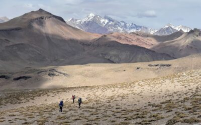
Hiking in the Rhodope mountains
Hiking in Turkey, Kirklareli